
-
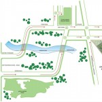
Location Map
The project site is located approximately 45 kms south east of Delhi, 15 kms south of Noida & east of the Yamuna river.
- It will be well connected with the Yamuna Expressway along its east boundary, Eastern Expressway on its west & ring road to South east.
- Proposed metro link would run parallel to the Yamuna Expressway.
- The main railway between Delhi & Agra runs along the west boundary.
- O Point (Greater Noida) – The time taken is 15 min (approx.)
- Noida / Greater Noida Expressway – The time taken is 25 min(approx.)
- South Delhi – The time taken is 35 – 42 min (approx.)

Highlights:
- 165 kms long, connecting Noida to Agra
- India’s Longest Access Controlled Expressway with Six Lane Concrete Pavement – slated to reduce the travel time between New Delhi and Agra to 2 hours from the present 4 hours
- Yamuna Expressway is poised to be Growth Engine for all round economic and industrial growth in western UP impacting a population of around 30 million.
- Yamuna Expressway Authority has identified ribbon development along Yamuna Expressway to promote Special Development Zones for core activities like IT, Industries, Biotechnology, Service Sectors & Commercial.
- Connecting National Capital Region with other parts of the state will boost economic activity, decongestion of existing roads and reduction in pollution.